
Portland Streetcar map
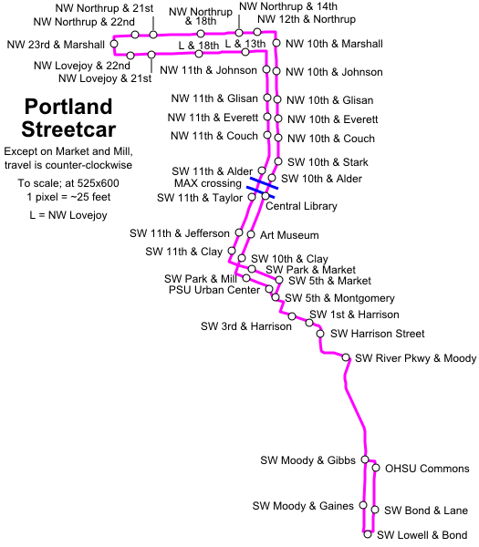
Geographically correct and with stop names
Made using official TriMet data that\'s been made publicly available for Google Transit and others. Data was loaded into a spreadsheet and converted to SVG coordinates using the formulas:
=((((Longitude-122)*256198)+62691308)/25)+125
-122: Remove whole number (entire map has same longitude integer)
*256198: convert to feet (from this calculator)
+62691308: Convert to positive numbers
/25: Shrink image
+125: Shift path over
and 583-((((Latitude-45)*364641)-180120)/25).
This map is also available in SVG format at Wikipedia